Saturday, March 12, 2011

Friday, January 28, 2011
Yellow Aster Butte Trail, North Cascades National Park
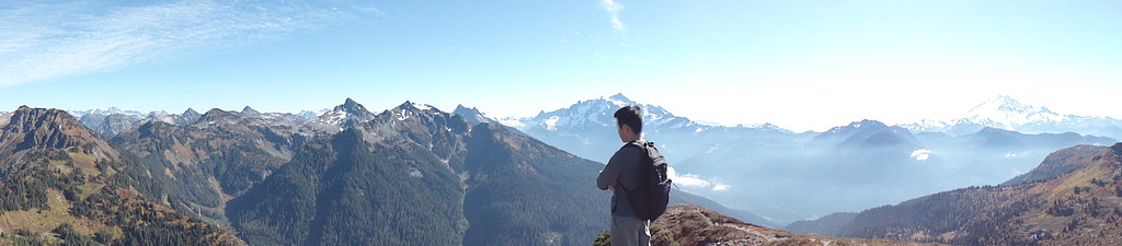
The Yellow Aster Butte Trail, (pronounced be-yoot) is located far north close to the Washington-Canada border. This hike is famous for it's fall colors so naturally the parking lot was full of cars upon arrival the second day of October.
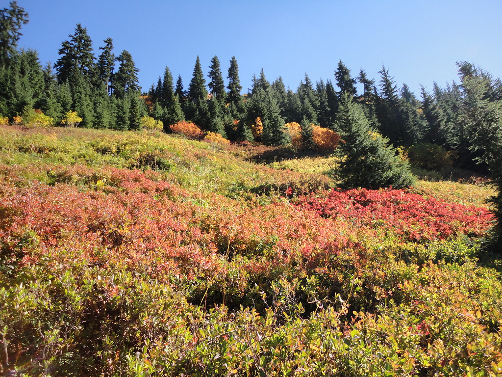
Despite the overwhelming amount of cars and having to park in a ditch half a mile from the trailhead, we didn't see too many people throughout the hike...probably due to the fact that we were either too fast for the slow people or too slow for the fast people.
About twenty minutes into the hike we realized both of us thought the other person had brought lunch...which was still sitting in the kitchen when we got home ten hours later. Lucky for us there were multitudes of Huckleberry bushes everywhere. Almost all of the red plants in the pictures are berry bushes.
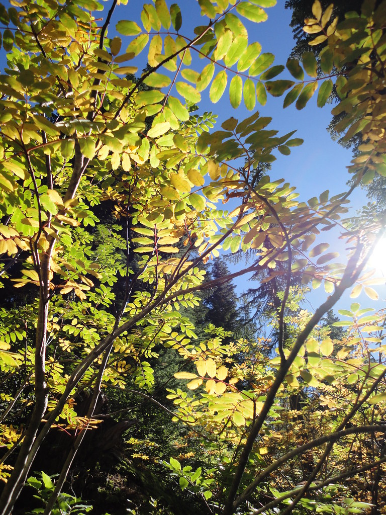
The trail instantly zigzags straight up a mountain before entering a sparse forest. Pretty looking trees are everywhere at this point but hardly a reward after climbing a small mountain. The forest area ends as abruptly as it starts and transforms into this:
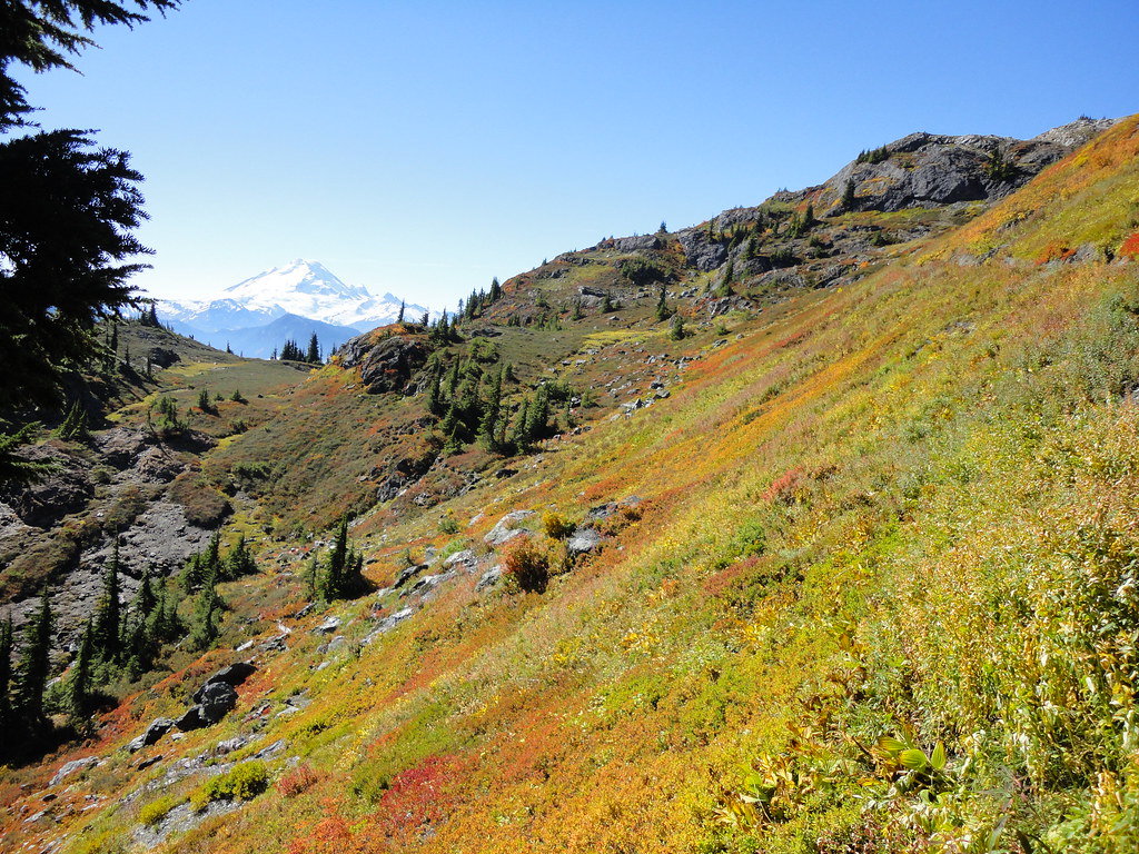
Mt. Baker is seen in the background with lunch seen in the foreground. By the end of the hike I never wanted to eat another berry again
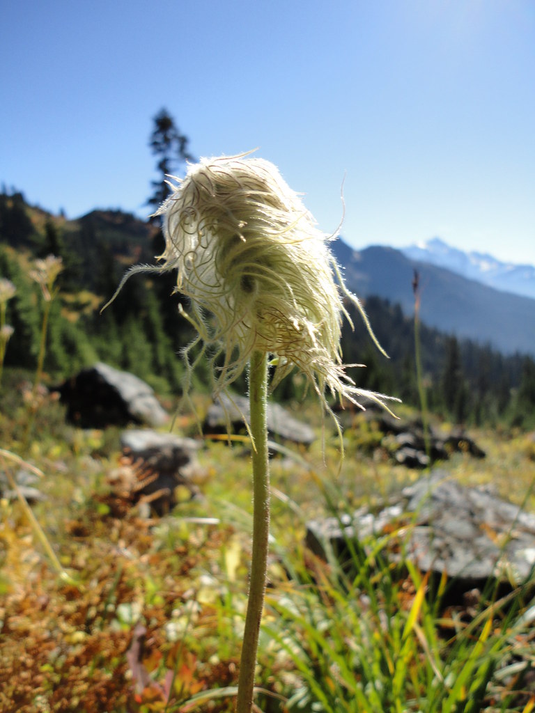
This is the strangest wildflower I've ever seen
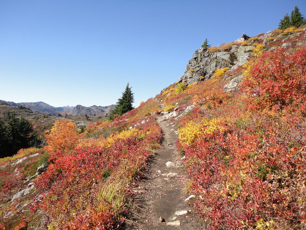
Continuing the ascent towards the end of the trail
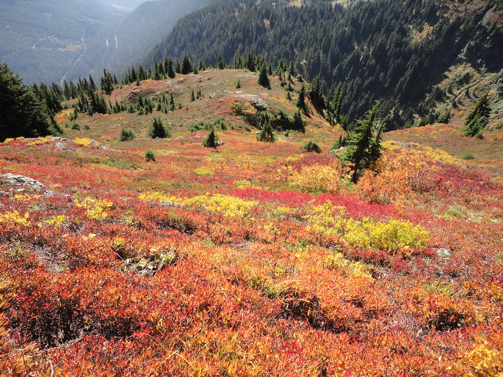
More berries.
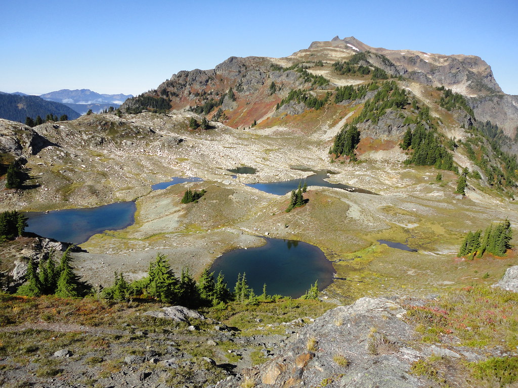
This plateau was carved out by glaciers that have since receded. This is 0.25 miles before the end of the hike. Not pictured is the 400 foot mountain still left to climb in that 0.25 miles to reach the end of the trail. The panoramic view from the top is well worth the effort and is pictured at the beginning of this post. The Yellow Aster Butte trail is 7.5 miles round trip and gains 2,550 feet with the peak being at 6,150 feet.
Monday, November 22, 2010
Skyline Divide Trail, North Cascades National Park
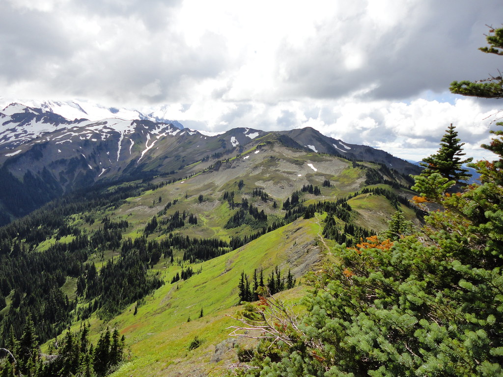
The Skyline Divide trail is located off Mt. Baker highway in the middle of nowhere. After two hours of driving through endless mountains, a small sign let us know we were almost there. The trail measures 9 miles round trip and gains 2500 feet. The highest peak sits at 6563 feet.
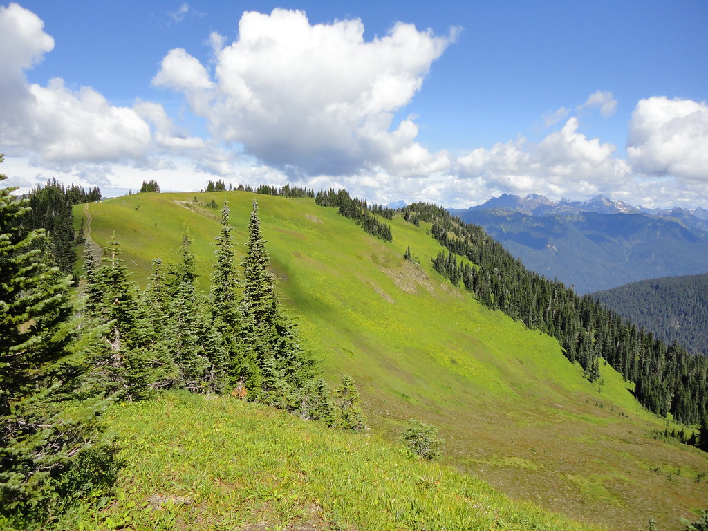
A brief incline through dense forest brings you to this - the hill from the Sound of Music.
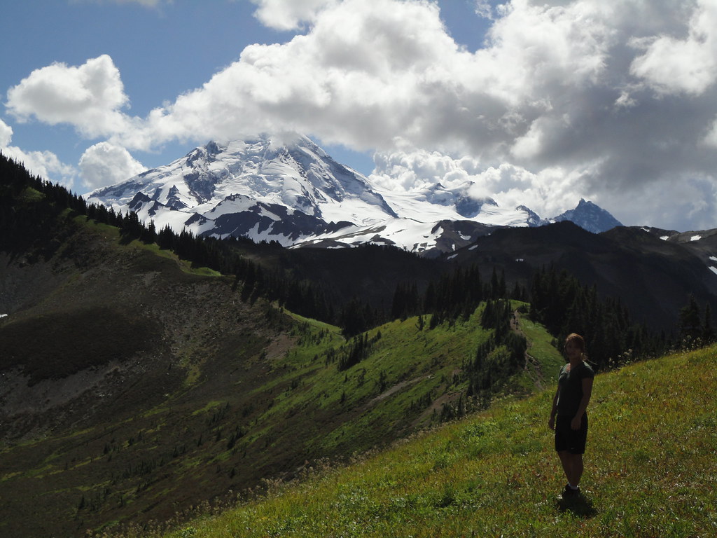
The illustrious Mt. Baker in the distance before becoming covered in clouds the remainder of the hike. The trail winds along the mountain ridge in the background before ascending the peak to the left.
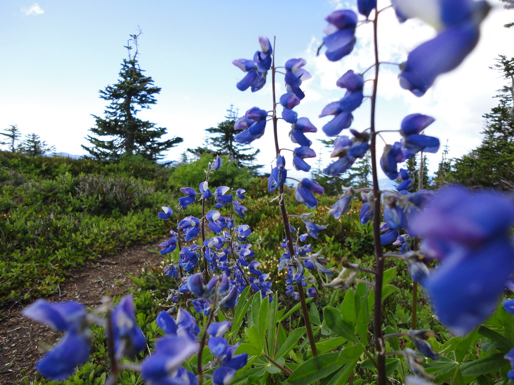
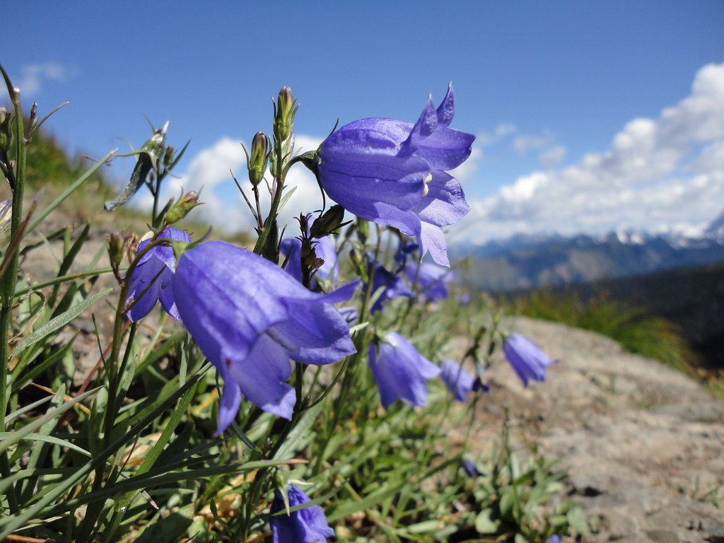
Lupin somewhere high up along the trail

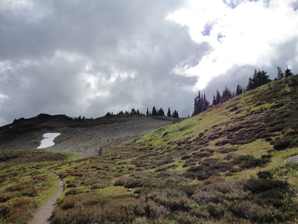
Continuing along the trail. The higher we hiked the shorter the trees became. These are known as Krummholz - trees distorted by continuous heavy winds at elevation. During the winter months snow protects the lower portion of the tree while winds destroy the upper part, giving them the fat bushy appearance.
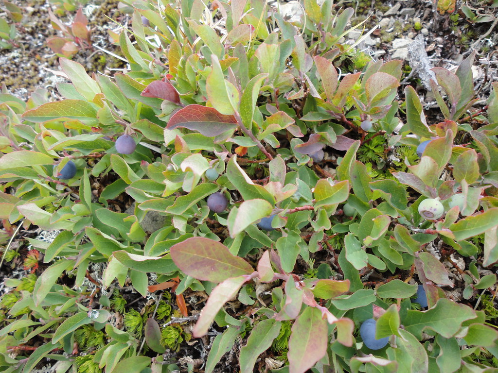
Lunch. These are Huckleberries and taste a lot better than blueberries.
Lunch. These are Huckleberries and taste a lot better than blueberries.
Tuesday, October 19, 2010
Hidden Lake Lookout Trail, North Cascades National Park
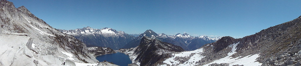
The Hidden Lake Lookout Trail is found off a tiny turnout from the Cascade River Road, which is a tiny turnout from Highway 20 in Washington State. I attempted to drive to the trailhead in April of this year but became discouraged when I met a man and his Subaru stuck in a snowy ditch halfway up the mountain. After two hours of helping this man get his car free, he began his hike on foot and I went home.
Several months later, I again drove up the mountain and by this time in August the snow was gone. This hike is approximately 9 miles round trip and gains 3,290 feet of elevation in 4.5 miles. The peak and its lookout tower sit at 6,890 feet.
Several months later, I again drove up the mountain and by this time in August the snow was gone. This hike is approximately 9 miles round trip and gains 3,290 feet of elevation in 4.5 miles. The peak and its lookout tower sit at 6,890 feet.
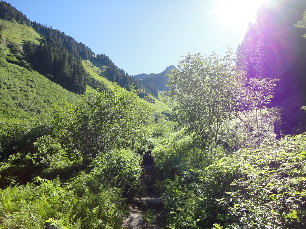
The beginning of the trail is deceptively benign and winds through numerous pine trees before breaking out into the valley pictured above.
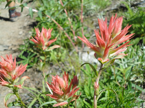
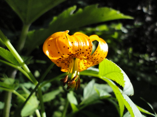
Due to the high elevation and therefore cold climate, spring and summer are short seasons in the Cascades. This August day was characterized by a multitude of wildflowers blooming everywhere. Most had no distinct smell, except one which smelled awful. The red flower is an Indian Red Paintbrush and the other is a Glacier Lily...neither of which smelled awful.
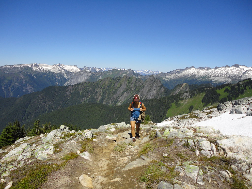
About an hour later, this is the view from what we thought was near the end of the trail. The valley with the flowers can be seen in the background.
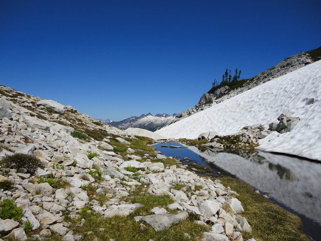
After yet another ascent, we arrived at this tiny lake high up in the mountainside. Everyone refers to these small bodies of water as Tarns. At this point we speculated the trail end must be around the corner.
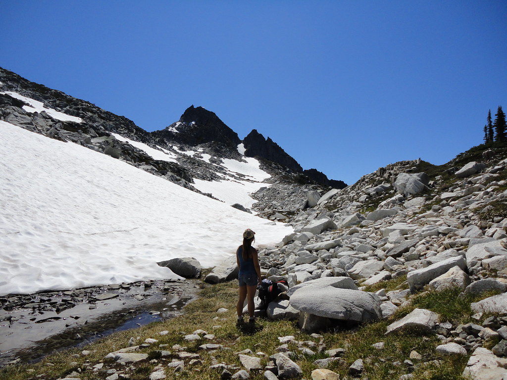
Little did we know that the actual end of the trail is up on Mt. Doom pictured in the background. The small white speck at the top of the black mountain is the lookout tower. The mountain isn't really called Mt. Doom.
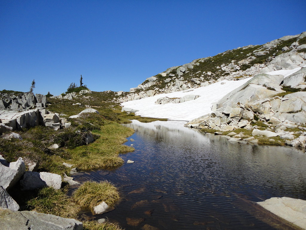
Still continuing to ascend, I came across this isolated tarn which would have been a perfect spot to camp for the night
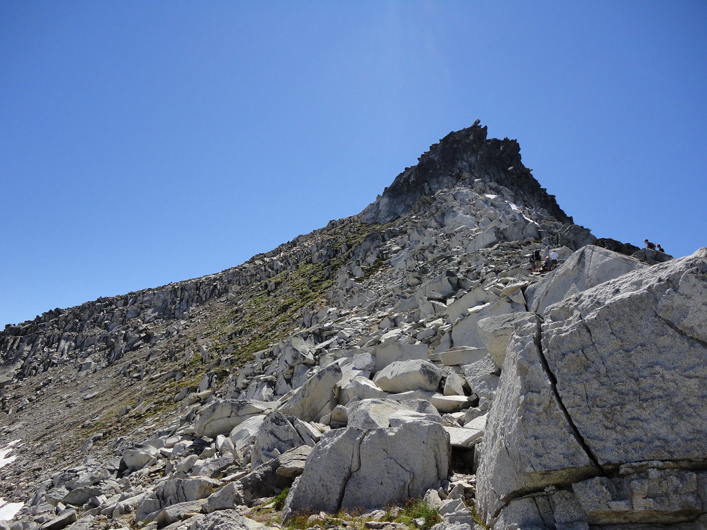
Several hundred (which felt like several thousand) feet higher, Mt. Doom finally felt within reach. At this elevation, most likely around 6,000 feet, trees and most plants ceased to grow. I'm not really sure why the mountain turns black towards the top.
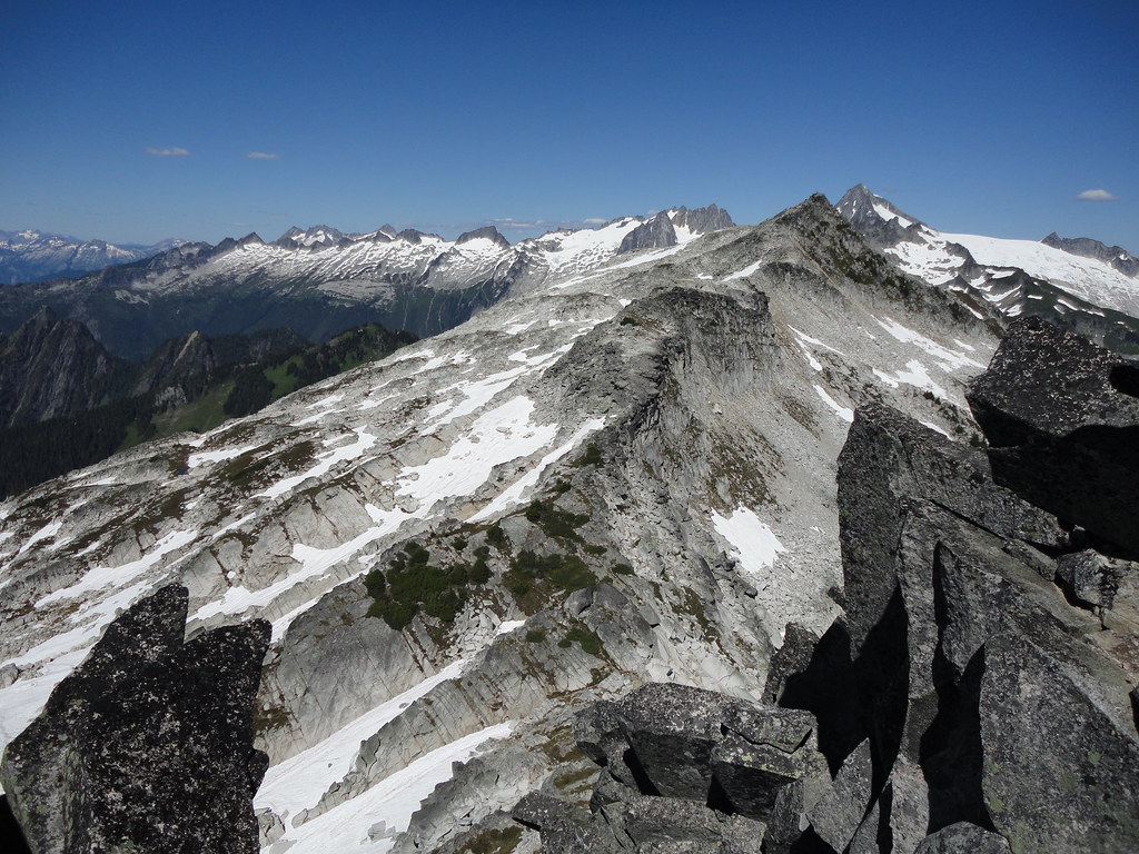
Approximately four hours from the start, we finally made it to the summit. This picture has poor perspective, but the light gray rock is actually a massive mountain several miles away. There were other hikers on the distant mountain but are too small to be seen here. Puny.
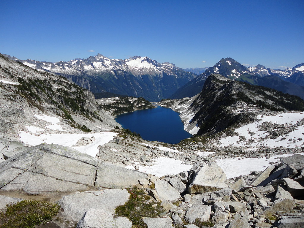
Hidden Lake, several thousand feet below.

My feet hurt thinking about the 4.5 mile hike to the car
Friday, October 1, 2010
Onna Village, Okinawa Japan
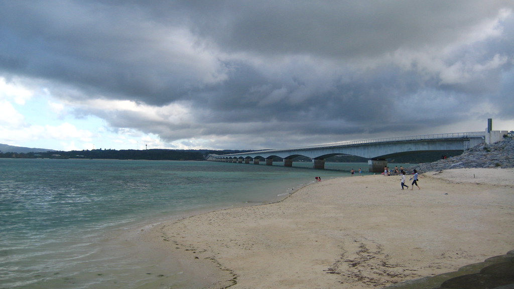
Onna Village is located on the west coast of the island and contains many of Okinawa's resort hotels and top snorkeling destinations. I attempted to visit as many of these locations as possible in the little free time I had.
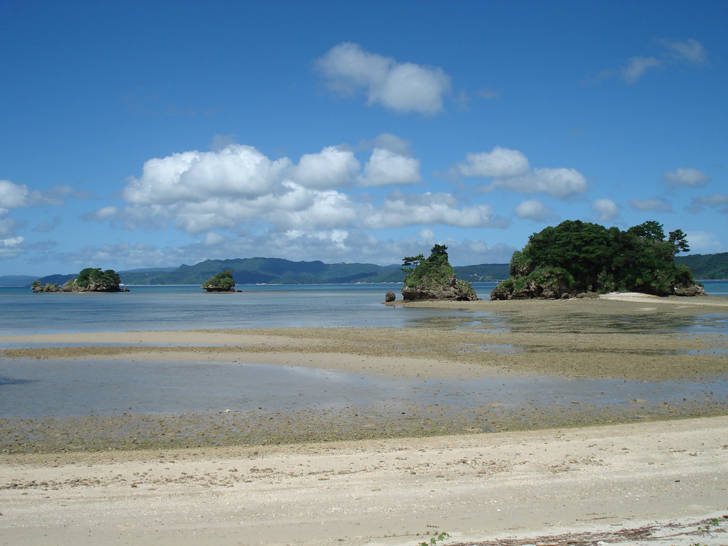
I don't believe this location has a name, but is very close to the Renaissance Beach and Hotel pictured on the right. This area was accessed from the back porch of a local bar. Bad children.
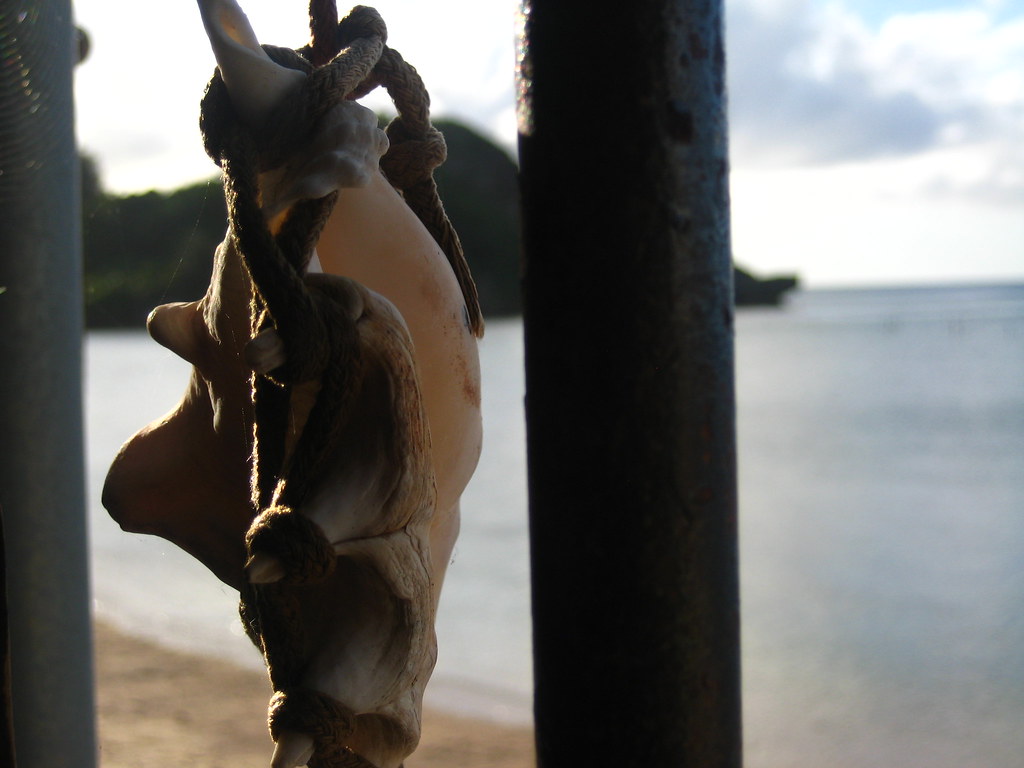
Bar decoration at sunset.
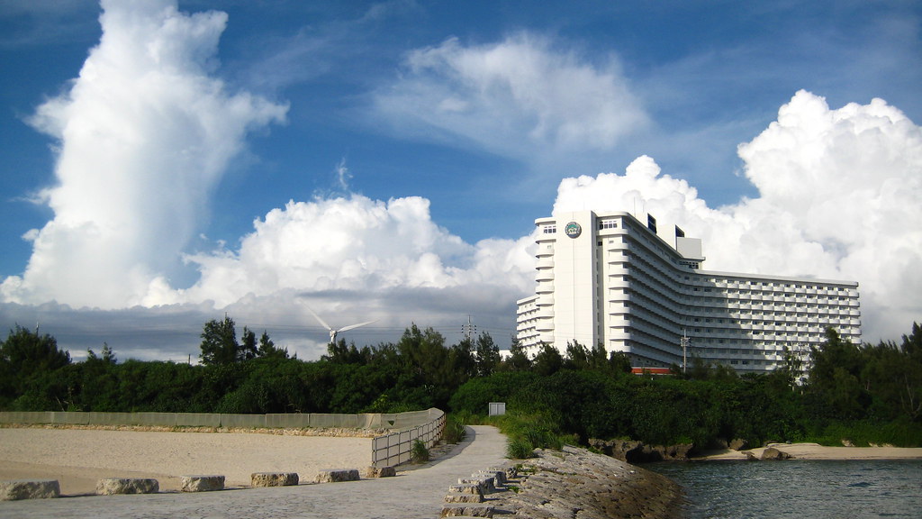
This is the Okinawa Zanpa Royal Hotel with Zanpa beach off to the left. The snorkeling here was decent but lacked marine life.
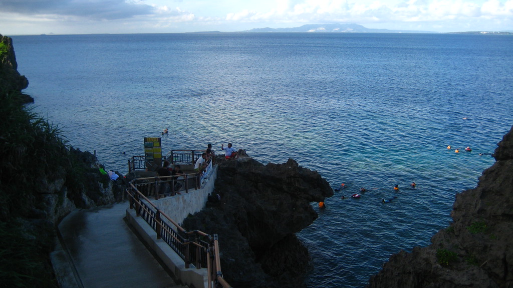
This is supposedly one of the top beaches in Okinawa. The fact that there were rocks everywhere, no people, and the smell of rotting seaweed led me to believe otherwise.
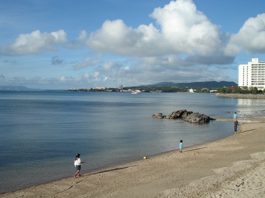
I don't believe this location has a name, but is very close to the Renaissance Beach and Hotel pictured on the right. This area was accessed from the back porch of a local bar. Bad children.
Bar decoration at sunset.
This is the Okinawa Zanpa Royal Hotel with Zanpa beach off to the left. The snorkeling here was decent but lacked marine life.
A little further north sits the famous Maeda Point - one of the top snorkeling destinations in the world. This is basically the only picture I have of this place as I did not want to bring my camera with me into the water. The diversity of marine life here was amazing. Around the corner to the right sits a massive cave lined with fire coral - a fact I found out the hard way.

This is Manza Beach and is easily the best beach I visited while in Okinawa.
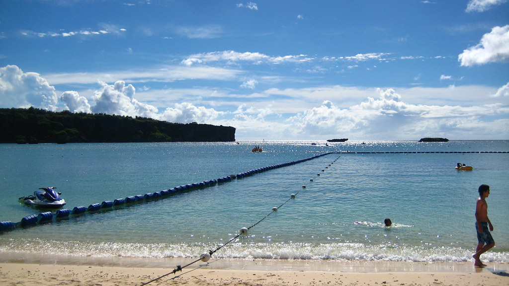
Like most of the popular beaches, Manza beach also came with a designated swimming area accompanied by signs warning of the deadly Box Jellyfish. Perhaps the crafty jellyfish snagged the missing rider of the jet ski.
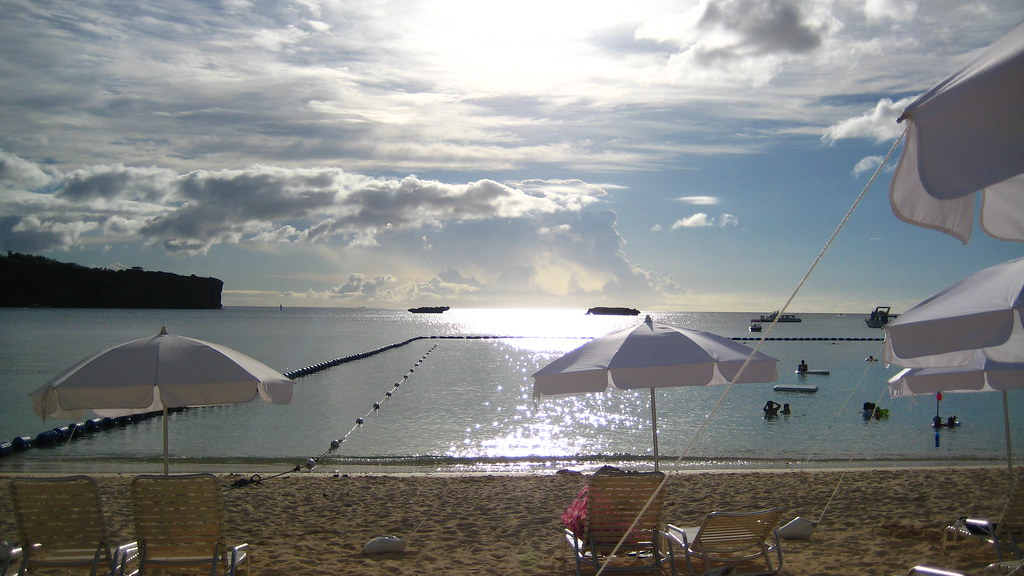
This is Manza Beach and is easily the best beach I visited while in Okinawa.
Like most of the popular beaches, Manza beach also came with a designated swimming area accompanied by signs warning of the deadly Box Jellyfish. Perhaps the crafty jellyfish snagged the missing rider of the jet ski.
Subscribe to:
Posts (Atom)