Monday, November 22, 2010

Skyline Divide Trail, North Cascades National Park

DSC01290

The Skyline Divide trail is located off Mt. Baker highway in the middle of nowhere. After two hours of driving through endless mountains, a small sign let us know we were almost there. The trail measures 9 miles round trip and gains 2500 feet. The highest peak sits at 6563 feet.

DSC01279

A brief incline through dense forest brings you to this - the hill from the Sound of Music.

DSC01276

DSC01269

The illustrious Mt. Baker in the distance before becoming covered in clouds the remainder of the hike. The trail winds along the mountain ridge in the background before ascending the peak to the left.

DSC01306

Lupin somewhere high up along the trail

DSC01309

Continuing along the trail. The higher we hiked the shorter the trees became. These are known as Krummholz - trees distorted by continuous heavy winds at elevation. During the winter months snow protects the lower portion of the tree while winds destroy the upper part, giving them the fat bushy appearance.

DSC01316

Lunch. These are Huckleberries and taste a lot better than blueberries.

DSC01325

Tuesday, October 19, 2010

Hidden Lake Lookout Trail, North Cascades National Park

DSC01173

The Hidden Lake Lookout Trail is found off a tiny turnout from the Cascade River Road, which is a tiny turnout from Highway 20 in Washington State. I attempted to drive to the trailhead in April of this year but became discouraged when I met a man and his Subaru stuck in a snowy ditch halfway up the mountain. After two hours of helping this man get his car free, he began his hike on foot and I went home.

Several months later, I again drove up the mountain and by this time in August the snow was gone. This hike is approximately 9 miles round trip and gains 3,290 feet of elevation in 4.5 miles. The peak and its lookout tower sit at 6,890 feet.

DSC01107

The beginning of the trail is deceptively benign and winds through numerous pine trees before breaking out into the valley pictured above.

DSC01122 DSC01126

Due to the high elevation and therefore cold climate, spring and summer are short seasons in the Cascades. This August day was characterized by a multitude of wildflowers blooming everywhere. Most had no distinct smell, except one which smelled awful. The red flower is an Indian Red Paintbrush and the other is a Glacier Lily...neither of which smelled awful.

DSC01154

About an hour later, this is the view from what we thought was near the end of the trail. The valley with the flowers can be seen in the background.

DSC01157

After yet another ascent, we arrived at this tiny lake high up in the mountainside. Everyone refers to these small bodies of water as Tarns. At this point we speculated the trail end must be around the corner.

DSC01158

Little did we know that the actual end of the trail is up on Mt. Doom pictured in the background. The small white speck at the top of the black mountain is the lookout tower. The mountain isn't really called Mt. Doom.

DSC01212

Still continuing to ascend, I came across this isolated tarn which would have been a perfect spot to camp for the night

DSC01174

Several hundred (which felt like several thousand) feet higher, Mt. Doom finally felt within reach. At this elevation, most likely around 6,000 feet, trees and most plants ceased to grow. I'm not really sure why the mountain turns black towards the top.

DSC01205

Approximately four hours from the start, we finally made it to the summit. This picture has poor perspective, but the light gray rock is actually a massive mountain several miles away. There were other hikers on the distant mountain but are too small to be seen here. Puny.

DSC01175

Hidden Lake, several thousand feet below.

DSC01196

My feet hurt thinking about the 4.5 mile hike to the car

Friday, October 1, 2010

Onna Village, Okinawa Japan

IMG_4239

Onna Village is located on the west coast of the island and contains many of Okinawa's resort hotels and top snorkeling destinations. I attempted to visit as many of these locations as possible in the little free time I had.

928593870_qnHCC-O

This is supposedly one of the top beaches in Okinawa. The fact that there were rocks everywhere, no people, and the smell of rotting seaweed led me to believe otherwise.

928593250_7CzkR-O

I don't believe this location has a name, but is very close to the Renaissance Beach and Hotel pictured on the right. This area was accessed from the back porch of a local bar. Bad children.

IMG_4231

Bar decoration at sunset.

IMG_4360

This is the Okinawa Zanpa Royal Hotel with Zanpa beach off to the left. The snorkeling here was decent but lacked marine life.

IMG_4218

A little further north sits the famous Maeda Point - one of the top snorkeling destinations in the world. This is basically the only picture I have of this place as I did not want to bring my camera with me into the water. The diversity of marine life here was amazing. Around the corner to the right sits a massive cave lined with fire coral - a fact I found out the hard way.

IMG_4489

This is Manza Beach and is easily the best beach I visited while in Okinawa.

IMG_4492

Like most of the popular beaches, Manza beach also came with a designated swimming area accompanied by signs warning of the deadly Box Jellyfish. Perhaps the crafty jellyfish snagged the missing rider of the jet ski.

IMG_4502

Saturday, September 4, 2010

Naha, Okinawa Japan

IMG_4545

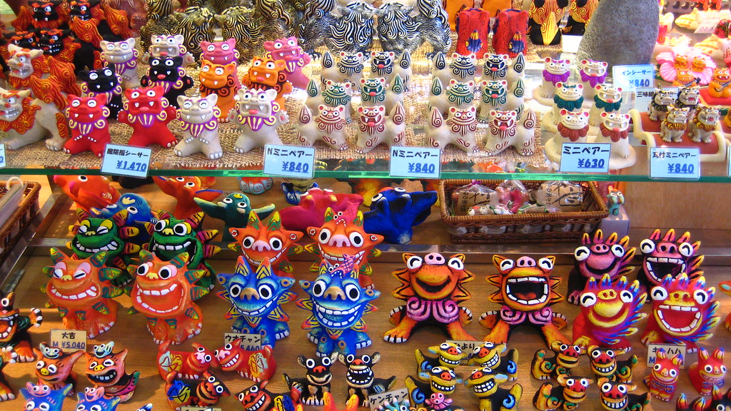
Naha is the capitol city of Okinawa, located on the southern west coast of the island and boasting a population of just over three-hundred thousand. The colorful figures above are the modern comical versions of Shisa - guardians of the city. Japanese mythology states that the Shisa come in a male / female pair. The female has her mouth closed to keep in good spirits, while the male has his mouth open to ward off the bad spirits. Shisa were everywhere on the island, usually placed on rooftops or in front of houses.

IMG_4177

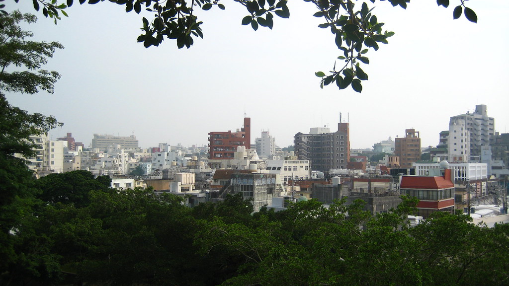
Naha city was named after a large mushroom-shaped stone (Naba) found within its borders. The stone eventually wore away and became buried and the cities pronunciation slowly changed to Naha. Very interesting. Here's a view of all three hundred thousand people's homes.

IMG_4021

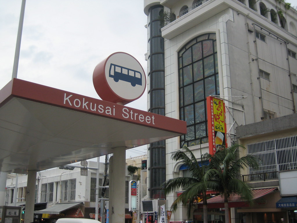
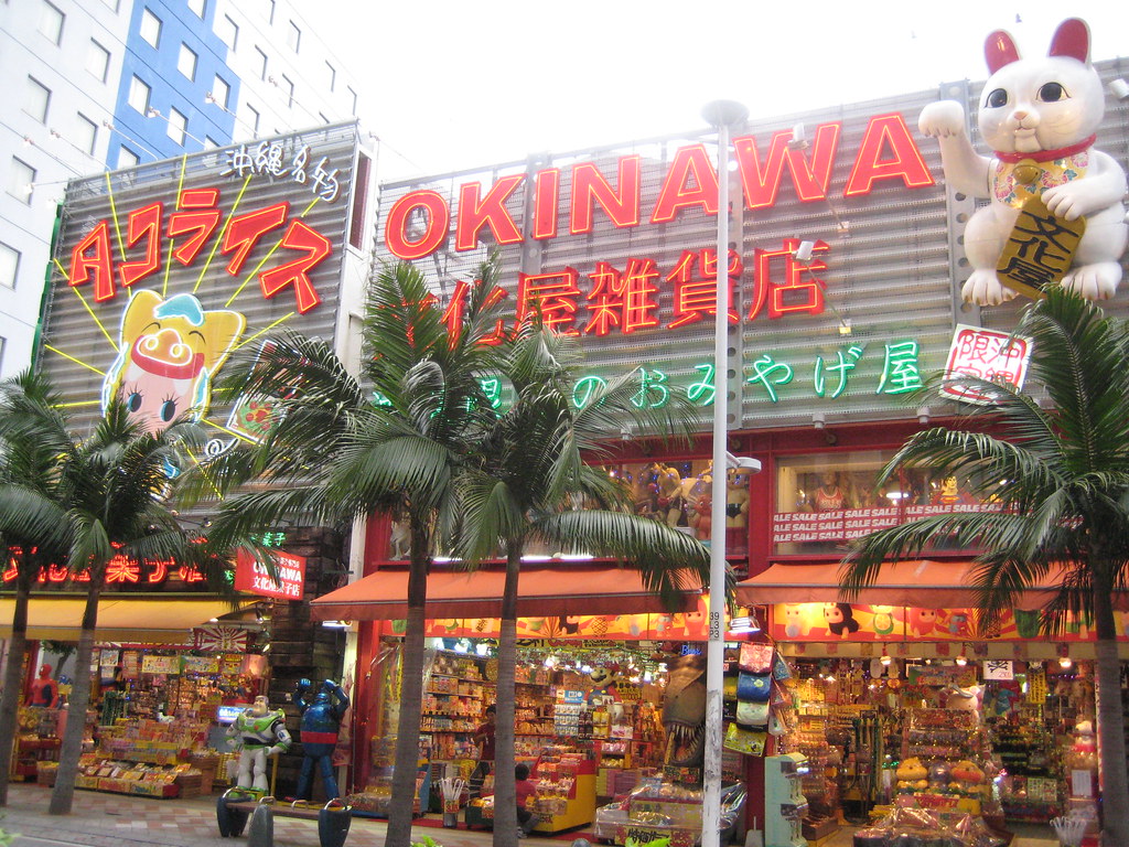
In the heart of the city lies Kokusai street. The street is about a mile long with a multitude of shops, bars, and restaurants spanning either side.

IMG_4029

Typical Kokusai Street shop complete with Buzz Lightyear and T-rex

IMG_4539

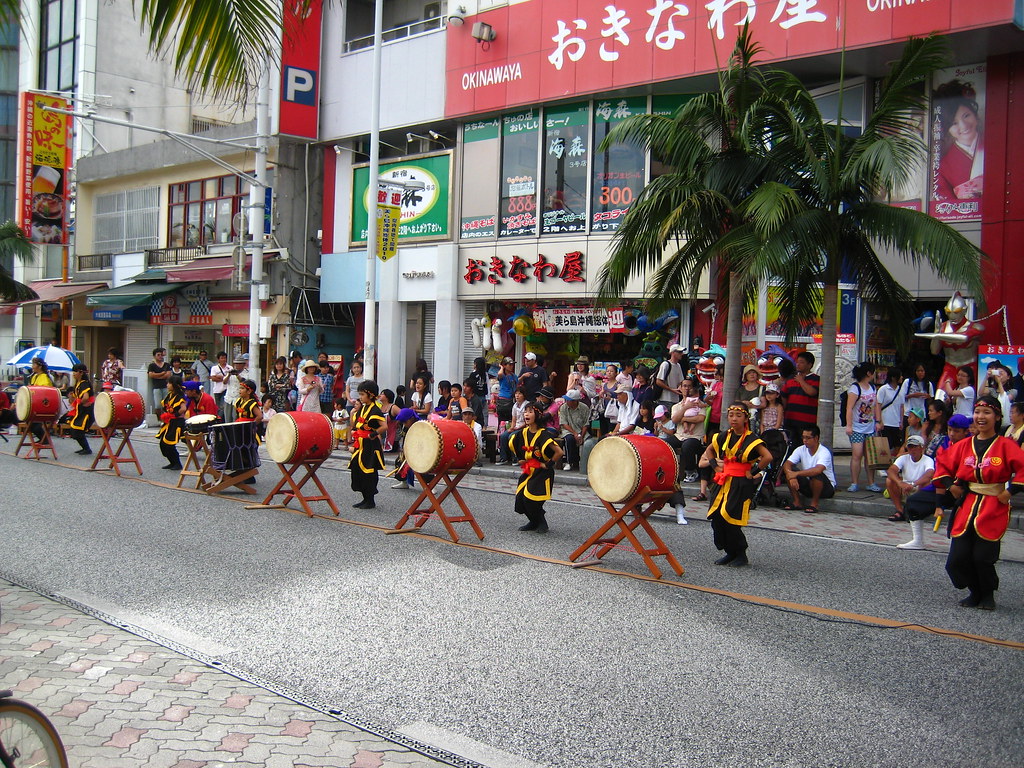
The street is closed off to commercial traffic on Sunday afternoons and performances like this are common up and down the street.

IMG_4020

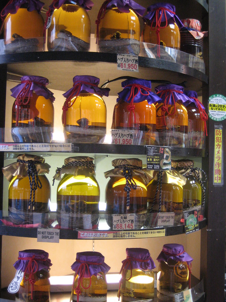
If you look closely you'll notice these bottles are filled with the local poisonous snake - the Habu Pit Viper. Approximately every 2 out of 1000 people are bitten by this snake annually. What better way to put it to use than stick it in a bottle of alcohol and take shots? The venom of the snake inhibits the liver from processing alcohol for a short time...meaning you'll get completely drunk all of a sudden. The funny thing about this drink, "Habu Sake", is that none of the locals drink it. It also costs about six hundred dollars for a large bottle.

IMG_4194

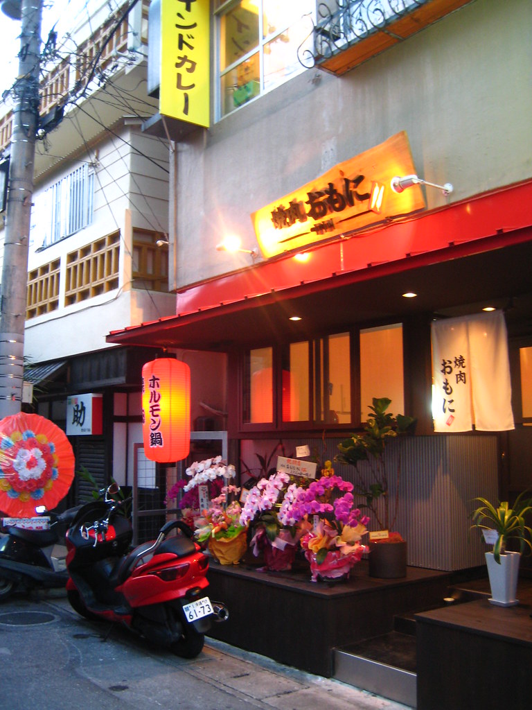
This is the most expensive Korean BBQ restaurant I have ever eaten at.

938332491_ZKoDi-O

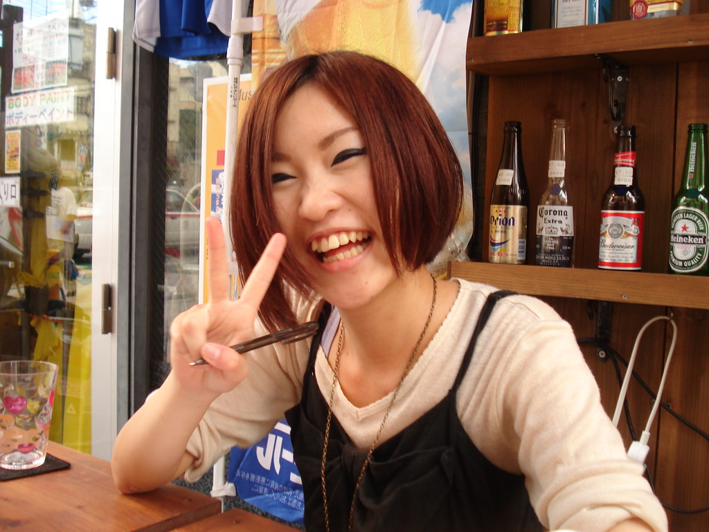
A friendly bartender working at a bar along the street. Her teeth are not the best.

IMG_4002

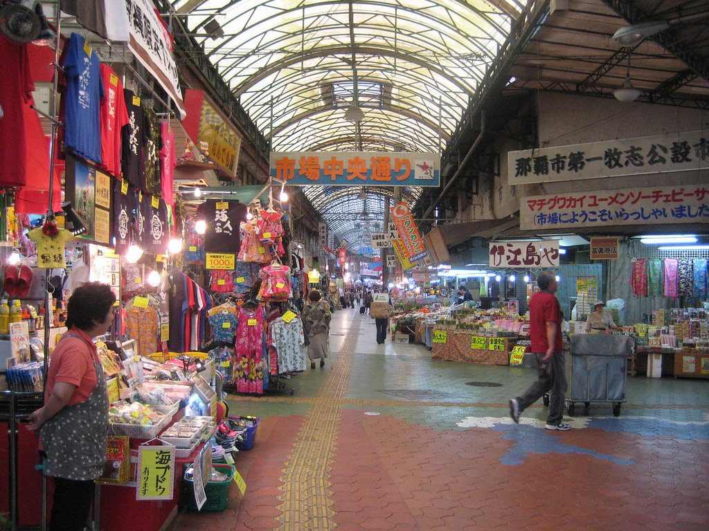
This is the famous Heiwa-dori Shopping Arcade. This covered tunnel eventually branches off in three or four directions and finding a way out becomes a challenge. This shop owner stares in dismay as a man walks into a cart.

IMG_4003

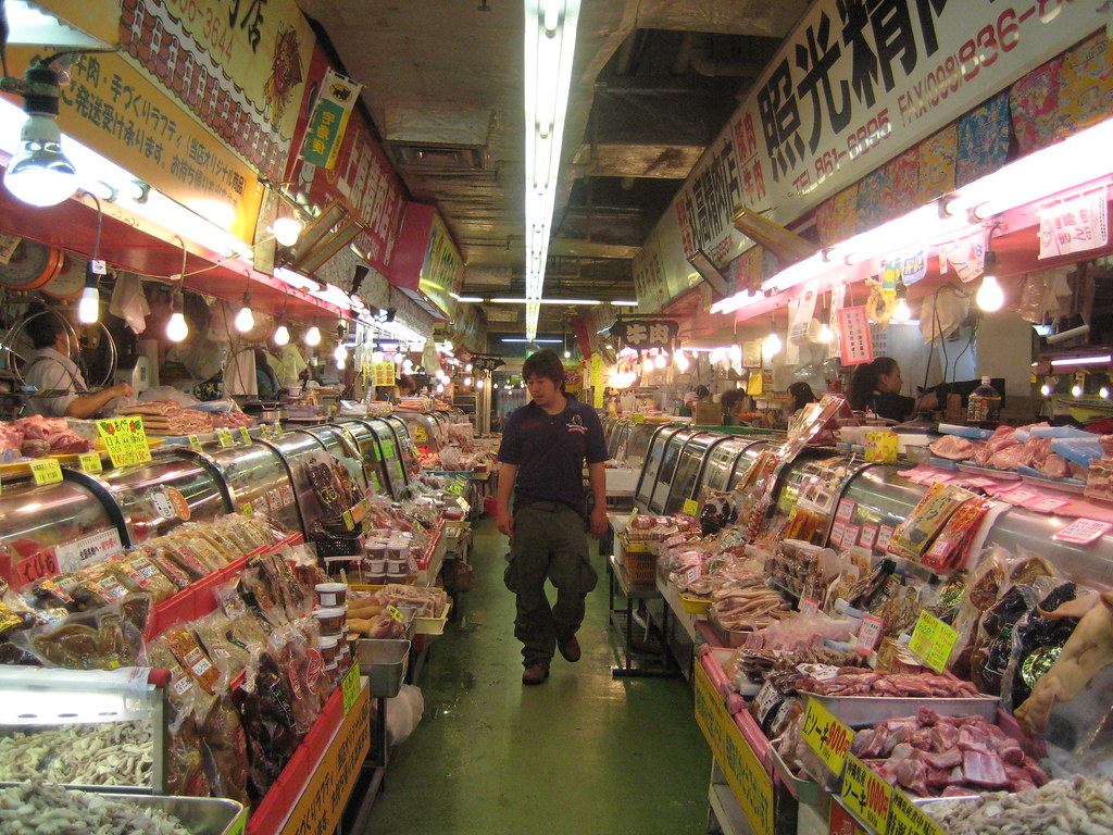
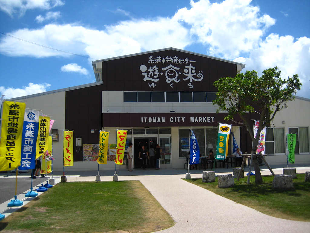
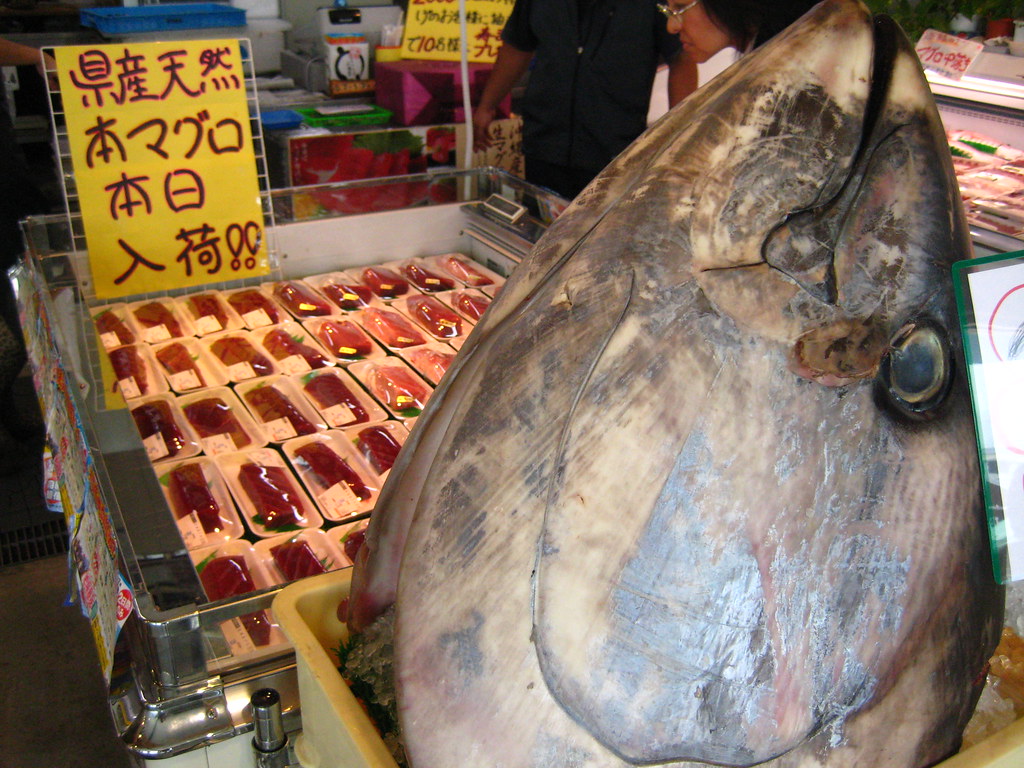
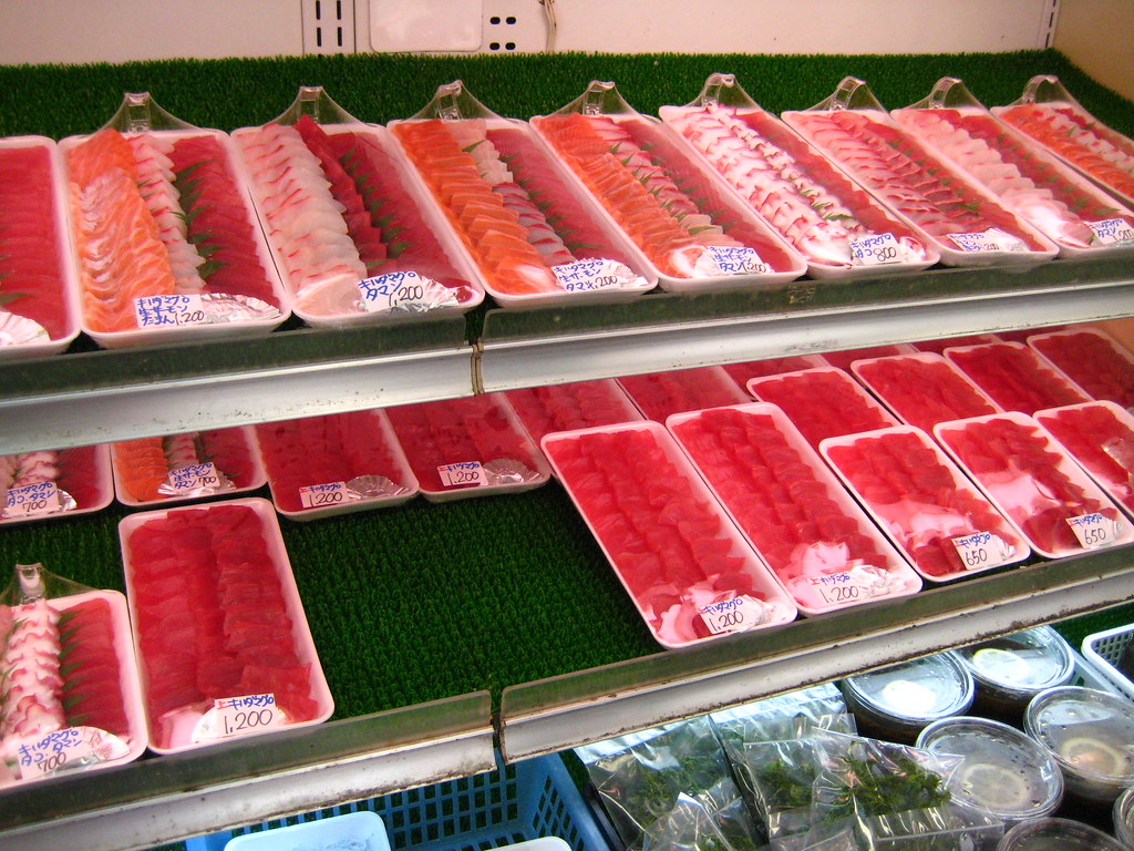
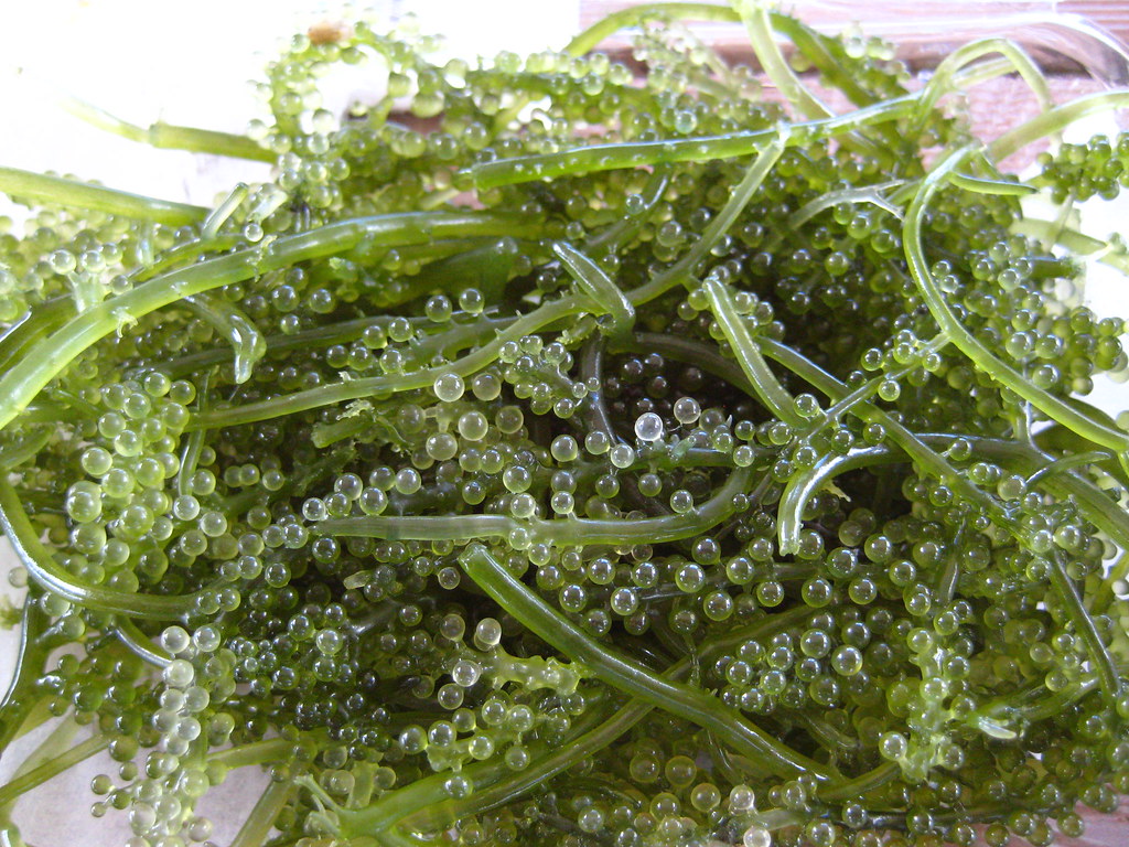
Somewhere inside the Shopping maze is the Makishi Public Market with its array of animal parts strewn about. Similar to the Itoman City Fish Market, this market also has ridiculously cheap Sashimi for sale.

IMG_3911

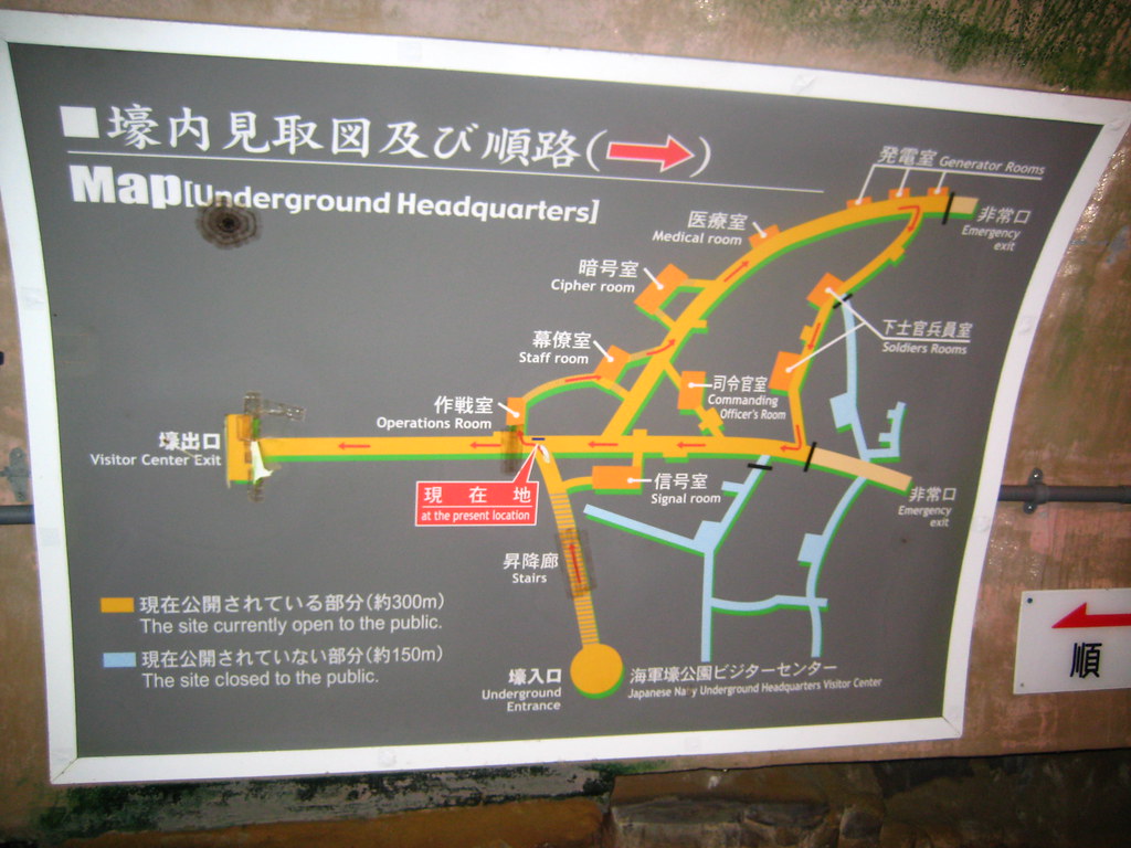
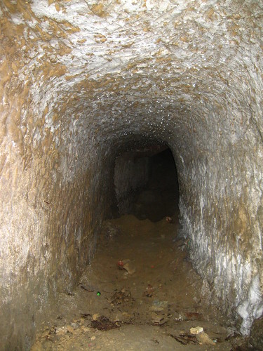
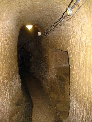
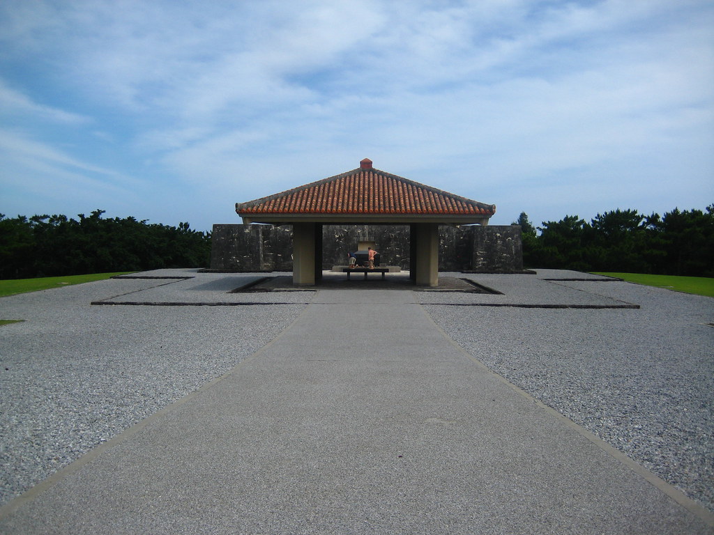
Away from the craziness of downtown, I took a tour of the secret Japanese underground headquarters used during World War II. The temperature in these tunnels was a welcome change from the horribleness outside.


IMG_3900

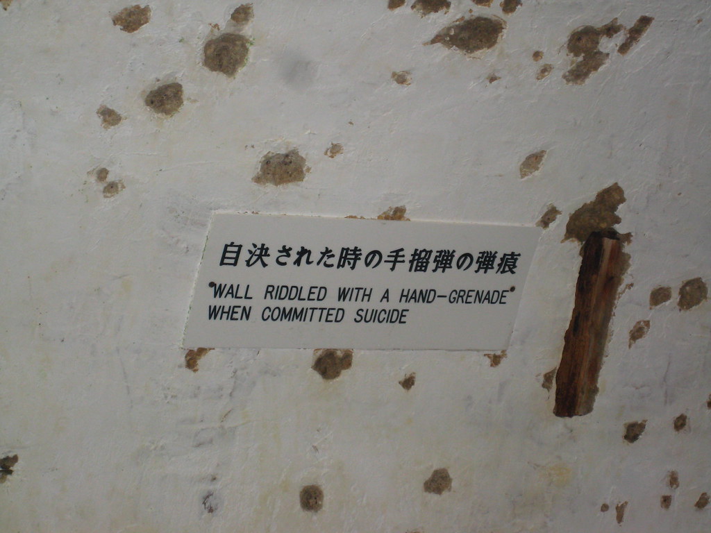
This was the most interesting room of the entire tour.

IMG_4517

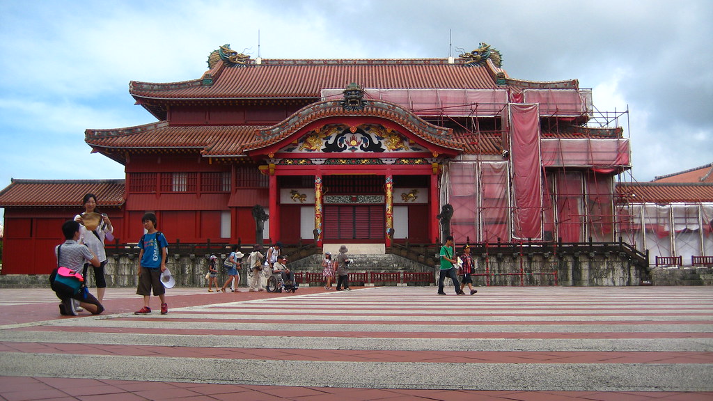
This is the famous Shuri Castle that served as the palace for the Ryukyu Kingdom centuries ago. According to records, the castle burned down several times throughout its history. The entire castle was completely destroyed again during World War II and finally rebuilt in 1992 based on photographs and drawings.

IMG_4520

The Seiden, or Main Hall of the Castle

IMG_4333

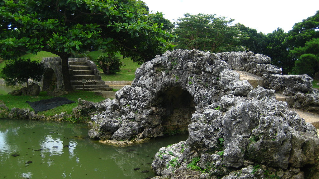
And lastly, I also visited what was referred to as "The New Jersey of Japanese Gardens". This is the backyard of a rich person's home which is now a museum.

Tuesday, August 17, 2010

Itoman City, Okinawa Japan

IMG_3964

Itoman City is located in the southernmost section of Okinawa approximately twenty-five miles from Kadena Air Base. Time spent here involved a visit to the Peace Park with it's suicide cliffs, a fish market, Bibi Beach, the Gushikawa Castle Ruins, and local deserted beaches.

IMG_3949

This is the Okinawa Prefectural Peace Memorial Museum. It houses ample amounts of World War II artifacts and historical recounts, most of which are written in Japanese. Unexploded bombs are on display below the see-through floorboards.


IMG_3951

Down the hill from the museum are hundreds of these stone tablets most likely listing the names of those who died during the war. The multiple rows are arranged in a semi-circle around this:

IMG_3954

This is the Cornerstone of Peace - a tribute to the dead.

IMG_3973

Wandering around the park further, I came across an old staircase that led to an outdoor corridor lined with strange monuments like the one above, below, and the first picture of this post. My friend's and I couldn't figure out what they were commemorating and eventually headed back to the museum. About a month later when I was trying to find the infamous suicide cliffs, all the google searches kept pointing to the Peace Park. Then I realized I had already seen the cliffs and these monuments were in memory of the families that jumped during the war.

IMG_3971

The Suicide Cliffs (not pictured because they are actually behind these monuments) are where entire families ended their lives during World War II. Terrifying rumors ran rampant about what the Americans would do once occupation of the island was won and rather than find out if these rumors were true or not, the Japanese chose to commit suicide.

IMG_4430

Away from the more depressing aspects of Itoman City and on a separate day, I visited the Itoman City Fish Market.

IMG_4435

Tuna head and tuna insides for sale.

IMG_4432

The best thing I have ever seen. These plates of sashimi cost a little more than twelve U.S. dollars each.

IMG_4441

The local seaweed. Eating this tasted exactly like drinking the ocean. Yum.

IMG_4453

After a visit to the fish market my friend and I stopped at Bibi beach. At this point in the day it was about 85 degrees with 4000% humidity...which made it feel closer to 110 degrees. Stepping out of the car's AC boundary led to profuse sweating.

IMG_4449

Note the beach's emptiness save for the hordes of people gathered in the small blue square. These roped off sections of water are common at all the frequented beaches and are designed to keep away a tiny animal - the Box Jellyfish. This creature is approximately a centimeter in length and transparent, making it nearly impossible to spot in the open ocean. A sting from this jellyfish almost always goes unnoticed. If left untreated, it can induce a heart attack in as little as twenty minutes earning it the reputation for most venomous creature in the world. Go Japan!

IMG_4461

The next destination was stumbled upon by accident while trying to find a quieter beach. Pictured above are the unmaintained ruins of Gushikawa Castle. Located on a cliff, these ruins overlook the southern shores of Okinawa Island and are overgrown with grass and various plants that house spiders as big as your face.

IMG_4464

A view of the coral reefs from the castle ruins where a man wishes he had brought shoes.

IMG_4467

After getting lost several times, my friend and I finally found a tiny road which led to a beach devoid of screaming children and square sections of swimming area. This is Nashiro Beach, I think, and was empty except for two kids trying to catch things in the water. I decided to snorkel for an hour or so and found nothing in the water except for sea slugs. The ridge in the background of the picture below led to a deserted beach shrine littered with ridiculously odd conch shells.

IMG_4473

Itoman City's various attractions were a welcome change from everything in the Kadena area of Japan. Here no one spoke English and almost everything was written in Japanese. I finally felt like I was in Japan.